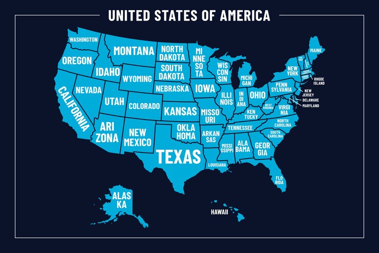
The map of the United States (US) is not just a geographical representation but also a rich tapestry of history, culture, and politics. Whether you’re a student, a traveler, or someone interested in the country’s unique structure, understanding the map of the US can provide a deeper insight into the nation. In this article, we will explore the US map, breaking down its regions, important landmarks, and geographical features.
The Basic Layout of the United States Map
Continental United States
The term “continental United States” refers to the 48 adjoining states on the mainland, excluding Alaska and Hawaii. This region is often what people refer to when they talk about the US map.
Alaska and Hawaii
Alaska, the largest state, is located in the northwestern part of North America, separated from the mainland by Canada. Hawaii, an island state, is situated in the Pacific Ocean, far southwest of California.
The Regions of the United States
1. Northeast Region
The Northeast is known for its dense population and historical significance. It includes states like New York, Pennsylvania, and Massachusetts.
- New England States: Maine, Vermont, New Hampshire, Massachusetts, Rhode Island, and Connecticut.
- Mid-Atlantic States: New York, New Jersey, and Pennsylvania.
2. Southeast Region
The Southeast is rich in agriculture, culture, and warm climates. This region includes states like Florida, Georgia, and the Carolinas.
3. Midwest Region
Known as “America’s Heartland,” the Midwest is often associated with farming and industry. States in this region include Illinois, Ohio, and Michigan.
4. Southwest Region
This region is recognized for its desert landscapes and strong Hispanic cultural influence. Arizona, New Mexico, and Texas are part of the Southwest.
5. Western Region
6. Pacific Northwest
This sub-region of the Western US is characterized by lush forests, mountain ranges, and rainy weather. It primarily includes Washington and Oregon.
7. Mountain States
The Rocky Mountains dominate this region, which includes states like Colorado, Utah, and Wyoming. Outdoor enthusiasts are drawn to the region’s national parks and rugged terrain.
8. Alaska and Hawaii Regions
Major Landmarks on the US Map
The map of the US is dotted with world-famous landmarks, both natural and man-made. These landmarks serve as symbols of American history, culture, and the environment.
1. The Grand Canyon
Located in Arizona, the Grand Canyon is one of the most famous natural landmarks in the world. Its vast size and unique geological features make it a popular tourist destination.
2. Mount Rushmore
Found in South Dakota, Mount Rushmore features the carved faces of four US presidents: George Washington, Thomas Jefferson, Theodore Roosevelt, and Abraham Lincoln.
3. Statue of Liberty
Situated in New York Harbor, the Statue of Liberty is a symbol of freedom and democracy. It was a gift from France to the United States in 1886.
4. Golden Gate Bridge
The Golden Gate Bridge in San Francisco, California, is an iconic symbol of the West Coast, famous for its striking red color and Art Deco design.
5. Yellowstone National Park
Yellowstone, primarily located in Wyoming, is the first national park in the US and features geothermal wonders like Old Faithful geyser.
Geographical Features of the United States
The US map showcases a variety of geographical features, from mountain ranges to vast rivers, each contributing to the country’s diverse ecosystem.
1. Mountain Ranges
- The Rocky Mountains: Stretching from Canada to New Mexico, the Rockies are one of the most prominent mountain ranges in North America.
- The Appalachian Mountains: Running along the eastern US, these mountains are among the oldest in the world.
- The Sierra Nevada: The Sierra Nevada, locating in California and Nevada, is known for its stunning peaks and deep valleys.
2. Major Rivers
- The Mississippi River: One of the longest rivers in North America, it flows from Minnesota to the Gulf of Mexico, providing crucial trade routes and water sources.
- The Colorado River: Running through the Grand Canyon, this river is vital for water and hydroelectric power in the Southwest.
- The Missouri River: As the longest river in the US, it flows through much of the Midwest.
3. Lakes
- The Great Lakes: Bordering the US and Canada, this group of five freshwater lakes (Superior, Michigan, Huron, Erie, and Ontario) is the largest in the world by surface area.
- Lake Tahoe: Located on the border of California and Nevada, it’s known for its crystal-clear water and stunning mountain scenery.
Political Map vs. Physical Map of the US
When looking at a map of the United States, it’s important to distinguish between political and physical maps, as each serves a different purpose.
Political Map of the US
A political map focuses on state boundaries, capitals, and major cities. It highlights the division of the country into 50 states and showcases the governance structure of each state.
Physical Map of the US
A physical map, on the other hand, focuses on the natural landscape. It shows mountains, rivers, lakes, and other geographical features, offering a better understanding of the land’s topography.
Maps for Different Purposes
Maps of the United States come in various forms depending on the need, and each has a specific function.
Road Maps
Road maps are designed for travelers and show highways, roads, and distances between locations. They often include information on rest stops, cities, and state boundaries.
Weather Maps
Topographic Maps
Topographic maps are detailed and show the elevation and terrain of the landscape. Hikers, geologists, and surveyors commonly use them.
Digital Maps and Modern Navigation
With the rise of technology, digital maps like Google Maps and Apple Maps have become essential tools for navigation. These maps provide real-time information, turn-by-turn directions, and even traffic updates, making travel easier than ever.
Google Maps
Google Maps is the most popular digital mapping tool, offering satellite imagery, street views, and real-time navigation. It’s a go-to for millions of users worldwide.
Apple Maps
Apple Maps is another digital navigation tool, available exclusively on Apple devices. It provides similar features, such as traffic updates and directions.
Conclusion
The map of the US is far more than a simple collection of lines and shapes. It reflects the rich diversity of geography, culture, and history that defines the nation. From the towering Rockies to the sprawling plains, and from bustling cities to quiet, rural areas, the US map tells the story of a vast and varied land. Understanding this map, and its many layers, is key to appreciating the complexity and beauty of the United States.
FAQs
1. How many states are there in the US?
There are 50 states in the United States.
2. What are the largest and smallest states by area?
Alaska is the largest state by area, and Rhode Island is the smallest.
3. What is the capital of the United States?
The capital of the United States is Washington, D.C.
4. How are time zones divided in the US?
5. Which river is the longest in the United States?
The Missouri River is the longest river in the United States.